Show results for
Explore
In Stock
Artists
Actors
Authors
Format
Theme
Genre
Rated
Studio
Specialty
Decades
Size
Color
Deals
- 4K Ultra HD Sale
- 50s Films Sale
- Action Sale
- Alternative Rock Sale
- Anime sale
- Award Winners Sale
- Bear Family Sale
- Blu ray Sale
- Blues on Sale
- British Sale
- Christmas in July
- Classical Music Sale
- Comedy Music Sale
- Comedy Sale
- Country Sale
- Criterion Sale
- Electronic Music sale
- Folk Music Sale
- Horror Sci fi Sale
- Kids and Family Sale
- Metal Sale
- Music Video Sale
- Musicals on Sale
- Mystery Sale
- Naxos Label Sale
- Page to Screen Sale
- Paramount Sale
- Rap and Hip Hop Sale
- Reggae Sale
- Rock
- Rock and Pop Sale
- Rock Legends
- Soul Music Sale
- TV Sale
- Vinyl on Sale
- War Films and Westerns on Sale

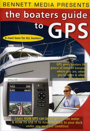
Boaters Guide to GPS
- Format: DVD
- Rated NR
- Release Date: 2/9/2010
Boaters Guide to GPS
- Format: DVD
- Rated NR
- Release Date: 2/9/2010
- UPC: 097278089875
- Item #: 347989X
- Rated: NR
- Genre: Special Interest-Instructional
- Release Date: 2/9/2010
- This product is a special order
- Run Time: 40 minutes
- Distributor/Studio: Bennett Marine Video

Product Notes
GPS gives boaters the peace of mind of knowing where you are, where you've been & where you're headed. All boaters have highly detailed digitized charts and GPS navigation available to them at a very reasonable cost. Even though these navigators are fairly simple to use, GPS devices can be intimidating to many users. With just a little effort anyone can easily learn to operate their equipment with proficiency and confidence. This program shows you the many ways GPS can assist on the water and just how easy it can be to take full advantage of this advanced technology. Most all boaters know that having a GPS navigator on board that takes them back to the dock or launch ramp under any weather condition is a huge advantage. GPS not only eliminates the worry of getting lost on the water, it shows you the way to any destination you want to go to. There are many valuable reasons for having a GPS chart plotter when you're out on the water. This program explains how satellite navigators are necessary for different applications ranging from inland lakes and waterways, to inshore and coastal waters, to offshore navigation on the high seas along with the different types of maps and charts that are available. Learn the various ways your boat's position can be marked and saved, how remote locations can be entered as waypoints, how routes can be formed and saved using waypoints, maps or charts, how routes can be recalled and navigated to, how to record your boat's track and how alarms and alerts can be set up and activated. It also explains features such as weather map overlays, sun and moon rise and set times, tide and current charts, built-in points of interest and the various types of navigation displays available and those that are best for certain applications. If you want to see just what GPS can do for you, how they operate along with the latest information on what is available, the Boater's Guide to GPS is just what you need! You'll learn: What GPS can do, Choosing a GPS Unit, Getting Started, Position Format, Accuracy, Maps & Charts, Speed, Course, Saving Waypoints, Identifying Waypoints, Going to Waypoints, Checking Routes, Routes, Forming Routes, Following Routes, Navigation, Tracks, Recording Tracks, Following Tracks, Alerts & Alarms, Sun & Moon Information.
